A big step towards a global approach to map and monitor surface water using satellite-based methods
The WorldWater initiative hopes to help national authorities and stakeholders improve water resources management
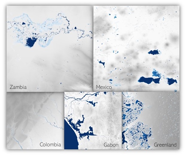
As part of the DHI-led WorldWater project funded by the European Space Agency - ESA, an evaluation of existing satellite-based surface water mapping algorithms has been concluded. 15 high performing algorithms applying either (or both) optical and radar (SAR) satellite data were compared and tested in five distinct
pilot areas worldwide. The goal was to better understand the pros and cons of using different sensors and models to detect and monitor surface water.
This activity has brought world-leading institutes and researchers one step closer to realising a unified approach to map and monitor surface water dynamics at a global level. Initial results indicate that dual sensor approaches, applying both optical and radar data, provide more accurate and consistent outputs under challenging conditions.
Ultimately, the WorldWater initiative hopes to help national authorities and stakeholders improve water resources management, by empowering them with Earth Observation data and tools to monitor surface water dynamics. Look out for our updates!
Learn more about the ‘WorldWater’ project at
https://worldwater.earth/
Read more