At DHI, we work tirelessly with you to solve riverine environmental challenges effectively. With our extensive experience of hydrology, water resources management, morphology and hydraulics, we strive to cater to both real-time operations and planning requirements for river management.
We highlight two recent river projects that we were recently involved in:
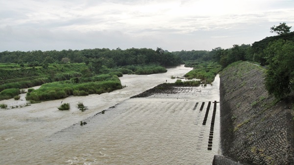
- Flood forecasting and early warning system for the Bengawan Solo River, Central Java, Indonesia
The longest river in the Indonesian island of Java, the Bengawan Solo, is heavily utilised – primarily for irrigation and drinking water – as it meanders through densely-populated Central Java. This means that frequent flood events along its length result in significant economic damage and human disruption.
|
Downstream view, showing erosion control structures along bank. © DHI
|
Over the past two years, we have established a flood forecasting and early warning system for the river, in partnership with local agencies and organisations. Based on a MIKE Powered by DHI’s MIKE 11 river model, the system is built within MIKE OPERATIONS to allow operators and decision-makers easy, intuitive access to real-time conditions and regularly-updated forecasts, as well as automated alerts when danger thresholds are exceeded.
- Producing probabilistic flood hazard results to assess overall risk for the Koshi River, Nepal
The sediment-rich Koshi River, which rushes out of the Himalayas and onto the lowlands of south-eastern Nepal, has historically spread widely across its floodplain, as one main channel silts up and the river shifts to another.
River embankments and a barrage, built in the 1950s, have reduced this periodic flooding and provided dependable irrigation water, enabling the significant agricultural development of the area in the years since. However, constricting the river in this way has also resulted in significant sediment deposition between the embankments, steadily increasing the likelihood of potentially-devastating embankment breaches – as happened in 2008, with disastrous results in Nepal and downstream India.
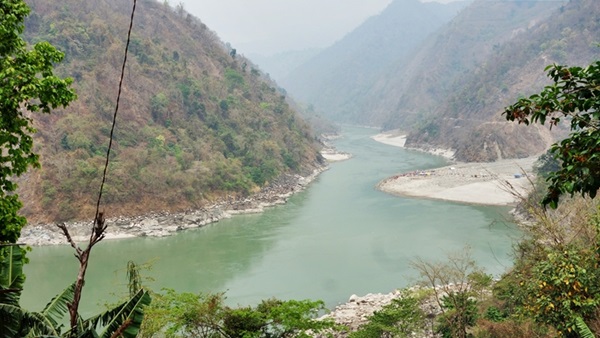 |
| Upstream views of the Koshi River as it emerges from the Himalayan foothills. © DHI |
Using the flexible capabilities of the MIKE1D API, we developed a probabilistic hazard modelling framework capturing stochastic embankment failure and sedimentation rates. Thousands of simulations were then performed making use of the parallelised MIKE1D engine to produce probabilistic flood hazard results. These results were then used to assess overall risk using a newly-developed interface between MIKE models and the open-source, probabilistic risk assessment software CAPRA.
Learn more about our river management projects as well as the tools and services we offer.